If you want to map all projects, click Submit. The list of projects displays at the bottom of the page.
If you want to show the location of specific projects,  filter the project list.
The interactive map shows the location of grant projects. You can show all projects on the map or filter the project list to show only specific projects.
The Results panel at the left side of the map displays the list of projects or the current theme you have applied to the map. You can close the Results panel to display the map in a larger size.
If you want to map all projects, click Submit. The list of projects displays at the bottom of the page.
If you want to show the location of specific projects, filter the project list.
Click Display Map. The map displays the location of all projects or selected projects based on your filter.
The project location is identified on the map with a symbol.
Click on thumbnail images to view full size. Click on the full-size image to return to thumbnail.

You can click on the symbol and display a tool tip containing a brief summary of the project.
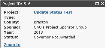
From the tool tip, you can zoom in on the location or access the project wizard for the project.
Privacy, Security and Accessibility | WV.gov | USA.gov | WVDOT | © 2012 State of West Virginia
 See Also